Gold in Prince William County, Virginia
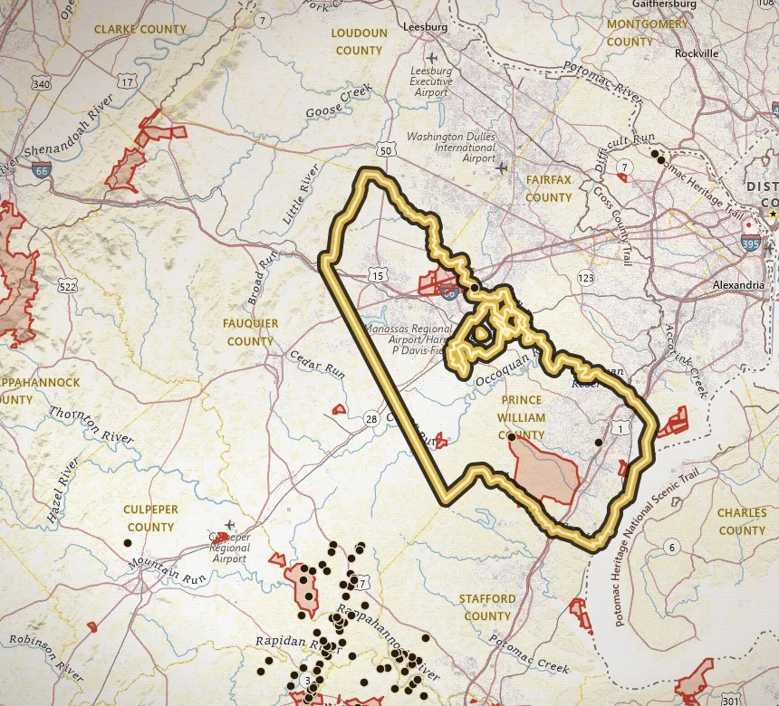
Prince William is the northern fringe of the belt, not a second Buckingham. The inventory here is thin: 2 documented gold sites, including Greenwood Prospect.
Open Prince William County on the map · Create a free account to zoom closer: 3 days of full access
Water to study: Occoquan and Bull Run drainages at the northern end of the belt.
That low count is the honest version of gold in Prince William County. The geology of the Gold-Pyrite Belt reaches this far northeast, but the mapped mine density does not. Parks, suburban parcels, and military or protected ground eat a lot of the map.
Greenwood Prospect is the named inventory site. Treat it as a pin to study against streams, faults, and land status, not a weekend pan location.
If you are researching the north end of the belt, pair this page with Fairfax and Stafford, then spend most of your map time in the denser Piedmont counties to the southwest.
Names that show up in the inventory
These are documented site names, not verified pan spots.
- Greenwood Prospect
Neighboring gold counties
Common questions
Is there gold in Prince William County?
Yes. Prince William County is Gold-Pyrite Belt country. VaGoldMaps lists 2 documented gold mines and prospects here. Historic lode workings and creek drainages are the research story. Confirm land access before you pan.
Can you pan for gold in Prince William County?
Only where you have permission or a lawful public-land allowance. Most of Virginia is private. Parks and wildlife management areas are closed to collecting. Prince William County is a research area, not a county-wide pan permit.
Where should I start on the map?
Open Prince William County on VaGoldMaps, keep streams on, and compare historic mine pins to the drainages. Occoquan and Bull Run drainages at the northern end of the belt. Then check land status and ownership before any field day.
All gold counties
- Louisa
- Spotsylvania
- Orange
- Buckingham
- Fluvanna
- Goochland
- Stafford
- Fairfax
- Halifax (Virgilina)
- Charlotte (Virgilina)
- Mecklenburg (Virgilina)
Gold in Virginia · Named historic mines
Open the map