Gold in Fluvanna County, Virginia
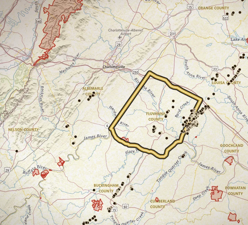
Fluvanna is thick with historic gold pins: 81 documented mines and prospects, including Tellurium on the Fluvanna / Goochland line near Columbia.
Open Fluvanna County on the map · Create a free account to zoom closer: 3 days of full access
Water to study: James River Piedmont reach near Columbia, plus the creeks that drain the Tellurium cluster.
Tellurium is the named camp with a full history page: an early productive lode mine with multiple inventory shafts and a paper trail from the 1830s onward. Snead, McGloam, Scotia, and Cloverdale are other named sites in the Fluvanna list.
The inventory is heavy on shafts and prospect pits, with a few adits, core holes, and placer entries. That pattern matches the broader Piedmont story: oxidized near-surface free gold first, then underground work, then creek gravel downhill.
The James River research reach for gold is this Piedmont country, not the Blue Ridge headwaters. Open the map on Columbia and Tellurium, trace streams, and confirm parcels. The river is not a county-wide pan permit.
Named mines in this county
-
Tellurium Mine
Tellurium is a classic early Virginia gold name on the Fluvanna / Goochland line near Columbia, with multiple inventory shafts and a long paper trail from the 1830s onward.
Names that show up in the inventory
These are documented site names, not verified pan spots.
- Tellurium Gold Mine
- Snead Mine
- McGloam Mine
- Scotia
- Cloverdale Mine
Neighboring gold counties
Common questions
Is there gold in Fluvanna County?
Yes. Fluvanna County is Gold-Pyrite Belt country. VaGoldMaps lists 81 documented gold mines and prospects here. Historic lode workings and creek drainages are the research story. Confirm land access before you pan.
Can you pan for gold in Fluvanna County?
Only where you have permission or a lawful public-land allowance. Most of Virginia is private. Parks and wildlife management areas are closed to collecting. Fluvanna County is a research area, not a county-wide pan permit.
Where should I start on the map?
Open Fluvanna County on VaGoldMaps, keep streams on, and compare historic mine pins to the drainages. James River Piedmont reach near Columbia, plus the creeks that drain the Tellurium cluster. Then check land status and ownership before any field day.
All gold counties
- Louisa
- Spotsylvania
- Orange
- Buckingham
- Goochland
- Prince William
- Stafford
- Fairfax
- Halifax (Virgilina)
- Charlotte (Virgilina)
- Mecklenburg (Virgilina)
Gold in Virginia · Named historic mines
Open the map