Gold in Goochland County, Virginia
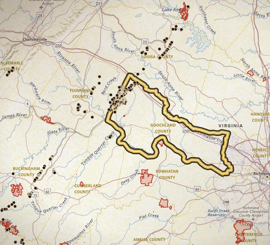
Goochland holds the largest gold inventory count on VaGoldMaps: 127 documented mines, prospects, and placer sites. That density is why the county keeps showing up in belt research.
Open Goochland County on the map · Create a free account to zoom closer: 3 days of full access
Water to study: James River Piedmont reach and Byrd Creek country, plus drainages off the Tellurium / Shannon Hill belt.
Named camps include Young America, Belzora, Bertha and Edith, Morgan & Waller, Benton, Bowles, Payne Tract (Caswell), and Shannon Hill. Tellurium sits on the Fluvanna / Goochland line near Columbia, so both county pages belong in the same study set.
Goochland is also where the inventory shows a lot of placer mines, not only shafts. Fine gold in creek gravel is the modern hobby story. It still requires permission. Most of this ground is private.
Start on the map at the Tellurium / Shannon Hill cluster, follow streams toward the James, and use parcel identify at higher zoom. A long list of pins is a research advantage, not a list of public digs.
Named mines in this county
-
Tellurium Mine
Tellurium is a classic early Virginia gold name on the Fluvanna / Goochland line near Columbia, with multiple inventory shafts and a long paper trail from the 1830s onward.
Names that show up in the inventory
These are documented site names, not verified pan spots.
- Young America Mine
- Belzora (Belzoro) Mine
- Bertha and Edith Mining Co
- Morgan & Waller Mine
- Benton Gold Mine
- Bowles Gold Mine
- Payne Tract (Caswell's) Mine
- Shannon Hill Property Mine
Neighboring gold counties
Common questions
Is there gold in Goochland County?
Yes. Goochland County is Gold-Pyrite Belt country. VaGoldMaps lists 127 documented gold mines and prospects here. Historic lode workings and creek drainages are the research story. Confirm land access before you pan.
Can you pan for gold in Goochland County?
Only where you have permission or a lawful public-land allowance. Most of Virginia is private. Parks and wildlife management areas are closed to collecting. Goochland County is a research area, not a county-wide pan permit.
Where should I start on the map?
Open Goochland County on VaGoldMaps, keep streams on, and compare historic mine pins to the drainages. James River Piedmont reach and Byrd Creek country, plus drainages off the Tellurium / Shannon Hill belt. Then check land status and ownership before any field day.
All gold counties
- Louisa
- Spotsylvania
- Orange
- Buckingham
- Fluvanna
- Prince William
- Stafford
- Fairfax
- Halifax (Virgilina)
- Charlotte (Virgilina)
- Mecklenburg (Virgilina)
Gold in Virginia · Named historic mines
Open the map