The Beale Papers: An 1885 Hoax Along Goose Creek, Not a Treasure Map
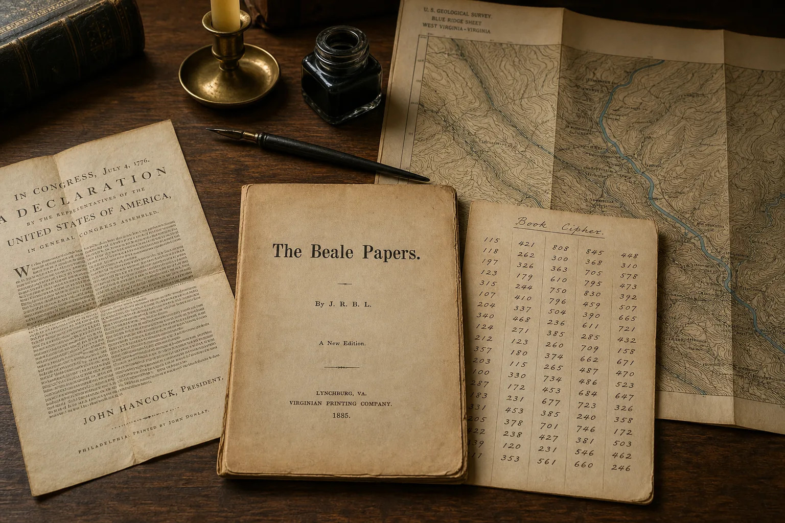
People still tell it as a Virginia treasure: three ciphers, a vault in Bedford County, and a fortune waiting for whoever finishes the decode.
The paper trail is older, smaller, and more useful than that.
In 1885, James B. Ward of Lynchburg copyrighted a fifty-cent pamphlet, The Beale Papers. It claimed Thomas J. Beale had buried gold, silver, and jewels near Buford's in Bedford County, then left the location in numbered ciphers. One cipher still opens. The other two have not, for 140 years, and they do not look like they were meant to.
The interesting Virginia story is not a missing key. It is how Ward wove family geography along Goose Creek into a secret-vault tale. That creek is real. The vault is not.
What the 1885 pamphlet claimed
The title page does the selling: authentic statements regarding treasure buried in 1819 and 1821 near Bufords, in Bedford County, Virginia, which has never been recovered. Printed in Lynchburg by the Virginian Book and Job Print. Entered for copyright by J. B. Ward.
The plot is a locked-box story. Robert Morriss, a Lynchburg innkeeper, allegedly received an iron box from a visitor named Thomas J. Beale. Inside, years later: letters, and three pages of numbers.
- Cipher 1 was said to give the location of a vault
- Cipher 2 was said to list the contents
- Cipher 3 was said to name the heirs
Beale, in the story, led thirty Virginians who found a mine west of Santa Fe, hauled the metal home, and buried it about four miles from Buford's. A key was supposed to arrive from St. Louis. It never did. Beale never came back. Morriss never solved the numbers. An unnamed friend later did, in part, and Ward brought the whole thing to print.
That is the pamphlet talking. Treat it as a pamphlet, not as a county record.
What actually decodes
Cipher 2 is a book cipher against the Declaration of Independence, using the numbering in the pamphlet. That decode has been public since 1885. We reproduced it. It still reads as English. A widely printed line is the one hunters quote:
I have deposited in the county of Bedford, about four miles from Buford's, in an excavation or vault, six feet below the surface of the ground...
That sentence is a demonstration. It proves the method can yield English. It does not prove a hole in the ground.
Cipher 1, run against the same Declaration and against the other usual suspects (Constitution, Articles of Confederation, Genesis, the pamphlet's own prose), comes out as gibberish. Cryptographer Jim Gillogly showed in 1980 that applying the Declaration to Cipher 1 produces an alphabetical run that looks like construction, not a second message. Cipher 3 looks even less like the solved text: long ascending runs, and numbers that sit on pamphlet page-size boundaries rather than on English word counts.
What people hunt
- A missing key for Cipher 1
- A vault four miles from Buford's
- Coordinates hidden in out-of-range numbers
What the sources support
- Cipher 2 is a working DOI demonstration
- Ciphers 1 and 3 behave like filler
- The geography is family creek country, not a pin
If you are still screening 19th-century documents as Cipher 1 keys, you are solving the wrong problem. The pamphlet already showed you it could encode English. It did that once, on purpose.
Why Ward fits
Joe Nickell said the quiet part in 1982, in The Virginia Magazine of History and Biography: there is no independent record of the pamphlet's Thomas J. Beale, the party of thirty, or the Santa Fe mine. Words in the letters (including stampeding) sit later than the 1820s they claim. The prose of "Beale" and the prose of Ward's pamphlet read like one hand. Ward was a Mason. Nickell read the secret-vault plot as Masonic allegory as much as treasure fiction.
That is still the scholarly baseline. We did not need a new decode to reach it. We needed to stop treating an unsolved page as evidence that a vault exists.
Local history fills in motive and means without needing a chest of gold:
- Ward's grandfather, James B. Risque, is tied in Bedford lore to a duel with a Thomas Beale near Montvale
- Ward and his brother-in-law John W. Otey ran a sawmill on Goose Creek in the 1850s, a couple of miles from the Buford tavern country the pamphlet uses as its landmark
- Ward's wife, Harriet Otey, was born on a farm in that corridor
- The Oteys and Bufords held Goose Creek land. Harriet's grandfather John H. Otey married into the Buford line
- Robert Morriss had business with that Otey family. Morriss family names sit in Ward's household story
- Paschal Buford's children later denied that Beale had stayed at the tavern
- Frances Buford, the tavern hostess of the relevant years, died in March 1884. The pamphlet is 1885. The last easy eyewitness was gone
Peter Viemeister's Bedford research is the usual map of that social web. You can argue with a detail and still see the shape: Ward did not pick Buford's off a gazetteer. He wrote a secret-vault story on ground his in-laws had walked.
Goose Creek as family geography
Goose Creek runs west through the Montvale and Buford's Gap country toward the Blue Ridge. The pamphlet's "about four miles from Buford's" sits on a real westward line along that stream: tavern and mill neighborhood in the valley, family farms and a sawmill up the creek, Blue Ridge hamlet country farther west.
That is why the legend feels local. It was built from local parts. A springhouse, a mill basement, a named gap, a four-mile sentence. Ward had all of that without burying anything.
The mistake is to take the sentence as a survey traverse. Treasure hunters have spent decades at Sharp Top, the Peaks of Otter, and Buford's Gap with metal detectors, treating Cipher 1 as unfinished cartography. Those landmarks are real. They are also the wrong job. A hoax set on a creek you know does not become a vault because the creek is on the USGS sheet.
Read it the way you would read Jefferson's Rappahannock paragraph: a famous Virginia story, a real drainage, and a claim that does not survive the paper trail. See Jefferson's Rappahannock gold.
What this is not: Bedford gold, Peaks of Otter
VaGoldMaps is a Virginia gold research map. Bedford County does show up on it. That does not make Beale a Gold-Pyrite Belt story.
The inventory pins a few gold prospects near Leesville, in the southern part of the county, down toward the reservoir country. Goose Creek and Montvale are western Bedford, against the Blue Ridge. Different neighborhood, different problem. Those Leesville ticks are ordinary historic mineral records. They have nothing to do with Ward's pamphlet.
For the statewide research hub, see gold in Virginia. Virginia's documented gold is Piedmont vein and placer country: the Gold-Pyrite Belt and Virgilina, named mines, mill sites, and creeks downhill from old workings. That story is in how Virginia's gold sits in the rock and the Virginia Gold guide. It does not run through a fictional vault four miles from a tavern.
The Peaks of Otter sit in park and parkway country. On this map, National Park, state park, and WMA boundaries draw in red for a reason. Prospecting and mineral collecting are closed there. A Beale legend does not punch a hole in that line.
How to study it on VaGoldMaps
Create a free account: 3 days of full access
This is desk research. The Montvale and Goose Creek valley is private farm, mill, and home ground. The map is for reading the drainage and the closed federal line, not for planning a dig.
- Open the full-screen map. Topo and drainages are on.
- Center western Bedford around Montvale and Buford's Gap. Find Goose Creek on the hydro layer. That is the pamphlet's neighborhood, as close as a modern map should put it without pretending we have a pin.
- Follow the creek west toward the Blue Ridge. You are reading family mill and farm country, not a vault sector.
- Note the red park and WMA lines toward the Peaks of Otter and the parkway. Tap a boundary. Closed to prospecting.
- Turn on Old workings and pan south toward Leesville if you want Bedford's actual gold prospects. Keep them in a separate mental pile from Beale.
- Zoom in on tracts only to remember that this is owned ground. A parcel line is not an invitation.
If you came here from a cipher forum, stay for the rest of the map. Historic mines, faults, LiDAR, and streams are how Virginia gold research actually works. Start with the Virginia Gold guide.
Land access reminder
Seeing Goose Creek, Montvale, Buford's Gap, a Bedford prospect tick, or a park boundary on the map does not mean you may enter, detect, dig, or prospect there.
Most of this ground is private. Listed plantations, mill remnants, cemeteries, and posted farms in the Goose Creek valley are not public treasure grounds. Parks, parkway, and WMAs are closed to prospecting and mineral collecting. Always confirm ownership and follow the rules.
VaGoldMaps is for research and education, not land access, claim status, or digging advice. The Beale Papers are a pamphlet. They are not a permit.
Sources
Primary and close-to-primary:
- James B. Ward, The Beale Papers, Containing Authentic Statements regarding the Treasure Buried in 1819 and 1821, near Bufords, in Bedford County, Virginia, and Which Has Never Been Recovered (Lynchburg: Virginian Book and Job Print, 1885). Text via Wikisource.
- Joe Nickell, "Discovered: The Secret of Beale's Treasure," The Virginia Magazine of History and Biography 90, no. 3 (July 1982): 310-324.
- Jim Gillogly, "The Beale Cipher: A Dissenting Opinion," Cryptologia 4, no. 2 (1980): 116-119.
Local history and later reading:
- Peter Viemeister, The Beale Treasure: A History of a Mystery (1997), on the Ward-Risque-Otey-Buford-Morriss web and Goose Creek mill country.
- Locust Level, National Register of Historic Places (VDHR 009-0018), for the Buford plantation landscape on Goose Creek. The listing is a historic-house record. It is not a treasure map, and the property is private.
- Virginia Energy / DGMR historic mineral inventory: Bedford gold prospects on the Leesville quad, unrelated to the pamphlet.
On this site:
- Jefferson's Rappahannock gold (another Virginia story the retellings inflate)
- How Virginia's gold sits in the rock
- National Park boundaries and prospecting on National Forest
Questions this story always raises
Is there a Beale treasure in Bedford County?
There is no good evidence for one. Cipher 2 is a demonstration that a book cipher can read as English. Ciphers 1 and 3 have not yielded a location in 140 years, and they look like filler. The pamphlet reads as 1885 fiction set on a real creek.
Did we solve Cipher 1?
No, and we stopped trying. The useful result is negative: the usual keys do not work, and the statistics do not look like a second English message. Hunting another 19th-century document is how the legend keeps itself busy.
Can I go look along Goose Creek?
Not from this map, and not as a public treasure field. Goose Creek around Montvale is private historic ground. Use the pamphlet to understand a Virginia hoax on a real drainage. Then study named mines and creeks you actually have a right to visit.
Is this the same as Virginia gold?
No. Virginia's documented gold is Piedmont vein and placer country, mainly the Gold-Pyrite Belt and Virgilina. Bedford's few inventory prospects sit near Leesville, not on the Beale creek. Do not mash the two stories together.
Final thought
Virginia does not need a lost vault to be interesting. It already has a gold belt, named mines, and creeks that still repay careful reading.
The Beale Papers earned their fame by looking like a map. Keep the sentence honest and they still earn a page: an 1885 Lynchburg pamphlet, one working cipher, a family creek, and no hole in the ground.
Open the map at VaGoldMaps · Create a free account: 3 days of full access, put Montvale in the middle, and read Goose Creek the way the pamphlet actually used it: as scenery for a story, not as a survey of a vault.