Spotsylvania County · Belmont
Goodwin Mine
Gold Hill beside Pigeon Run, now inside Lake Anna State Park. Local histories call Goodwin a major 1830-1849 producer. You can walk the old mining country on park trails, including the AllTrails Goodwin Gold Mine Loop.
Open on map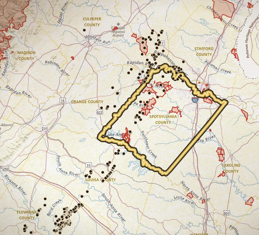
- Known for
- Gold Hill camp on Pigeon Run; major antebellum name in Spotsylvania
- Also spelled
- Goodwyn Mine in Virginia Energy / MRDS records
- First reported
- Gold here by about 1829 (park and county accounts)
- County / quad
- Spotsylvania County · Belmont
- Walk it
- Lake Anna State Park trails; AllTrails Goodwin Gold Mine Loop (~6.9 mi, moderate)
- Inventory
- MRVID 171A-804 · MRDS W00451 (listed as Goodwyn Mine)
- Site type
- Quarry / open pit on file; about 5 acres; reclaimed status noted
Spotsylvania remembers this ridge-and-creek country as Gold Hill. The mine most people call Goodwin appears in Virginia Energy records as Goodwyn Mine.
That spelling split is the first research clue. Same camp, two labels. County histories, park tours, and trail apps say Goodwin. The mineral inventory and MRDS say Goodwyn.
Unlike most Virginia gold pins, this one sits where you can walk the story on public park trails. Lake Anna State Park keeps visitor-center exhibits, gold-panning programs, and guided Goodwin mine tours. The hiking route many people follow is the community Goodwin Gold Mine Loop on AllTrails, stitched from official park trails around Mill Pond, Pigeon Run, and Gold Hill.
Where it sits
Virginia Energy lists Goodwyn on the Belmont 7.5′ quadrangle in western Spotsylvania (MRVID 171A-804, MRDS W00451). The catalogued site type is quarry / open pit, about 5 acres, with a reclaimed note on abandoned-mine records.
On the ground the name that stuck is Gold Hill, along Pigeon Run, now inside Lake Anna State Park (6800 Lawyers Road, Spotsylvania). The park opened in 1983 on land that was already a gold-mining landscape. Nearby inventory points on the same Belmont cluster are often unlabeled quarry / open-pit gold records. Treat Goodwin as the named center of a tight neighborhood, not a single isolated hole.
Park interpretation still ties the camp to Pigeon Run: early washings along the creek, then hillside openings where veins were followed. That is the same Gold-Pyrite Belt pattern as Whitehall farther northeast in the county and Vaucluse in Orange: oxidized near-surface work first, deeper pyrite-bearing ground later. See how Virginia gold sits in the rock.
The 1829 find and the antebellum years
Park and county accounts date gold here to about 1829. Through the 1830s and 1840s the Goodwin / Gold Hill name was one of the better-known eastern producers, in a county that already had Whitehall as Virginia's first well-known lode locality (1806).
Spotsylvania histories often call Goodwin the third-largest gold mine in the country from 1830 to 1849. Statewide summaries more often say Virginia ranked among the top gold-producing states in that same window (commonly third, before California reset the map). Keep those two claims separate. The local line is about this camp. The state line is about the whole Piedmont belt. Both are why Gold Hill still shows up in park brochures.
Period writers also place Goodwin in a dense Spotsylvania cluster. Park material sometimes speaks of a couple dozen mines in the wider local area. On VaGoldMaps that cluster is the point: open Historic mines, then pan along Pigeon Run and the Belmont pins rather than treating one coordinate as the whole story.
Later work, then a state park
Local narratives push peak work into the later nineteenth century, with legal and company trouble in the mid-1880s and closure not long after. Treat late-century dollar talk as color unless you have a primary production table in hand. Sweet's inventory and the Virginia Energy record are the cleaner modern index: name, quad, site type, acres, references (Sweet and Trimble 1983, Cline et al. 1921, Sweet 1980, Luttrell 1966, Watson 1907, Hotchkiss 1881).
What you can verify on a visit is the park layer. Virginia State Parks says visitor-center exhibits trace the area's gold mining, nature and gold-panning programs are popular, and the park offers guided tours of the Goodwin Gold Mine. A DCR park note also warns that old shafts in the Gold Hill woods can be deep, with unsteady walls, and recommends seeing the mine with interpretive staff. That is the honest field rule: walk the trails, take the tour, do not climb into historic openings.
Park interpretation on the observation deck has pointed out where plant sat: water tank, boilers, a steam engine, jaw crusher, and stamp mill. You are looking at a former industrial camp, not a picnic-table rumor.
Walk Gold Hill: the AllTrails loop
The route people share as the Goodwin Gold Mine Loop is an AllTrails community loop, not a single official blaze with that name. AllTrails currently lists it around 6.9 miles, moderate, a few hours, with a few hundred feet of climbing, and a strong review count. Typical write-ups start on the flat Mill Pond trail (Hailey's mill country), follow Pigeon Run into quieter woods and a stream crossing, then climb the Gold Hill trail past power-line openings and old mining texture.
Official park mileages for those pieces (hiking, and mostly shared with bikes and horses) are:
- Mill Pond Trail: 0.7 mile, blue blaze
- Pigeon Run Trail: 1.4 miles, purple blaze (moderate)
- Gold Hill Trail: 3.1 miles, white blaze (moderate; longest named park trail)
Download the current Lake Anna State Park trail guide before you go. Park hours are dawn to dusk. Day-use parking fees apply, and the beach / picnic lots can fill on summer weekends. Gold Hill, Pigeon Run, and Big Woods are the harder-rated trails. Stay on marked paths. Do not enter pits, sloughs, or shafts. Recreational gold panning, if offered, is a park program with park rules, not a license to dig the historic workings.
What LiDAR shows near the pin
Topo gives you Pigeon Run, the park roads, and the contour story. LiDAR strips the canopy and shows bare-earth roughness: pits, cuts, and benches that look like ordinary woods until you zoom in.
Open the Goodwin pin with LiDAR and streams on. Compare the named Goodwyn record with unlabeled Belmont pits next door. Then pair that with water: any placer story here follows Pigeon Run leaving the old Gold Hill landscape toward the lake. Use the layer as a research clue, not a dig permit.
For a fuller walkthrough of the layer, see What LiDAR can show you before you ever hit the creek.
How to study Goodwin on VaGoldMaps
Open the map pin for this page. You are centering the Virginia Energy inventory point for Goodwyn Mine.
- Historic mines: Compare the Belmont cluster, then pan toward Whitehall and the Wilderness / Vaucluse country. Spotsylvania is a belt story, not one famous hole.
- Streams: Trace Pigeon Run and the drainages leaving Gold Hill. Lode history and placer research questions share the same water network.
- LiDAR: Look for disturbed ground, old cuts, and benches under canopy.
- Parks: Keep the state-park boundary in mind. This pin is public-land context. Neighboring historic mines often are not.
- Structure: Add faults when you want a "why here" overlay on top of the name-and-date story.
For inventory fields on any marker (names, MRDS, references, reclamation rank), see the Field Note on historic mine details.
Access and honesty
Goodwin is one of the few Virginia gold names you can study with your boots on public trail. That still is not a free pass to collect, metal-detect the workings, or enter historic openings. Confirm park rules, stay on marked trails, and join a ranger tour if you want the mine interpreted up close.
Surrounding parcels outside the park remain private. Historic coordinates on this page are for research. VaGoldMaps is a research map: history, geology, drainage, and (here) a real walk, before you lace up.
If you only remember one Goodwin fact, remember this: Gold Hill on Pigeon Run, reported by about 1829, filed today as Goodwyn, and still walkable inside Lake Anna State Park. Everything else on this page is how to put that pin (and that loop) to work.
Related research
Sources
- Virginia Energy DGMR inventory (MRVID 171A-804, Goodwyn Mine; MRDS W00451; Sweet and Trimble 1983, Cline et al. 1921, Sweet 1980, Luttrell 1966, Watson 1907, Hotchkiss 1881)
- Sweet, P.C. (1980), Gold in Virginia, Virginia Division of Mineral Resources Publication 19
- Virginia Department of Conservation and Recreation, Lake Anna State Park (visitor center, gold-panning programs, guided Goodwin Gold Mine tours; trail mileages for Gold Hill, Pigeon Run, and Mill Pond)
- Virginia State Parks, Which Virginia State Park Had a Goldmine? (Gold Hill / Pigeon Run context; shaft-safety note; plant interpretation)
- Spotsylvania County historic notes on Gold Hill and the Goodwin Mine (antebellum producer claim; 1829 discovery)
- AllTrails, Goodwin Gold Mine Loop (community loop of official Lake Anna State Park trails; https://www.alltrails.com/trail/us/virginia/goodwin-gold-mine-loop)
VaGoldMaps is for research and education. Historic mine coordinates are not a claim to ownership or access. Confirm land status and get permission before any field visit.