Buckingham County · Willis Mountain
Booker Mine
First-wave Buckingham commercial gold on Bernard Gaines Booker's plantation (early 1830s). Later Garnett & Moseley, then Morrow. Documented open cuts, underground work, and a major mid-century stamp mill northwest of Willis Mountain.
Open on map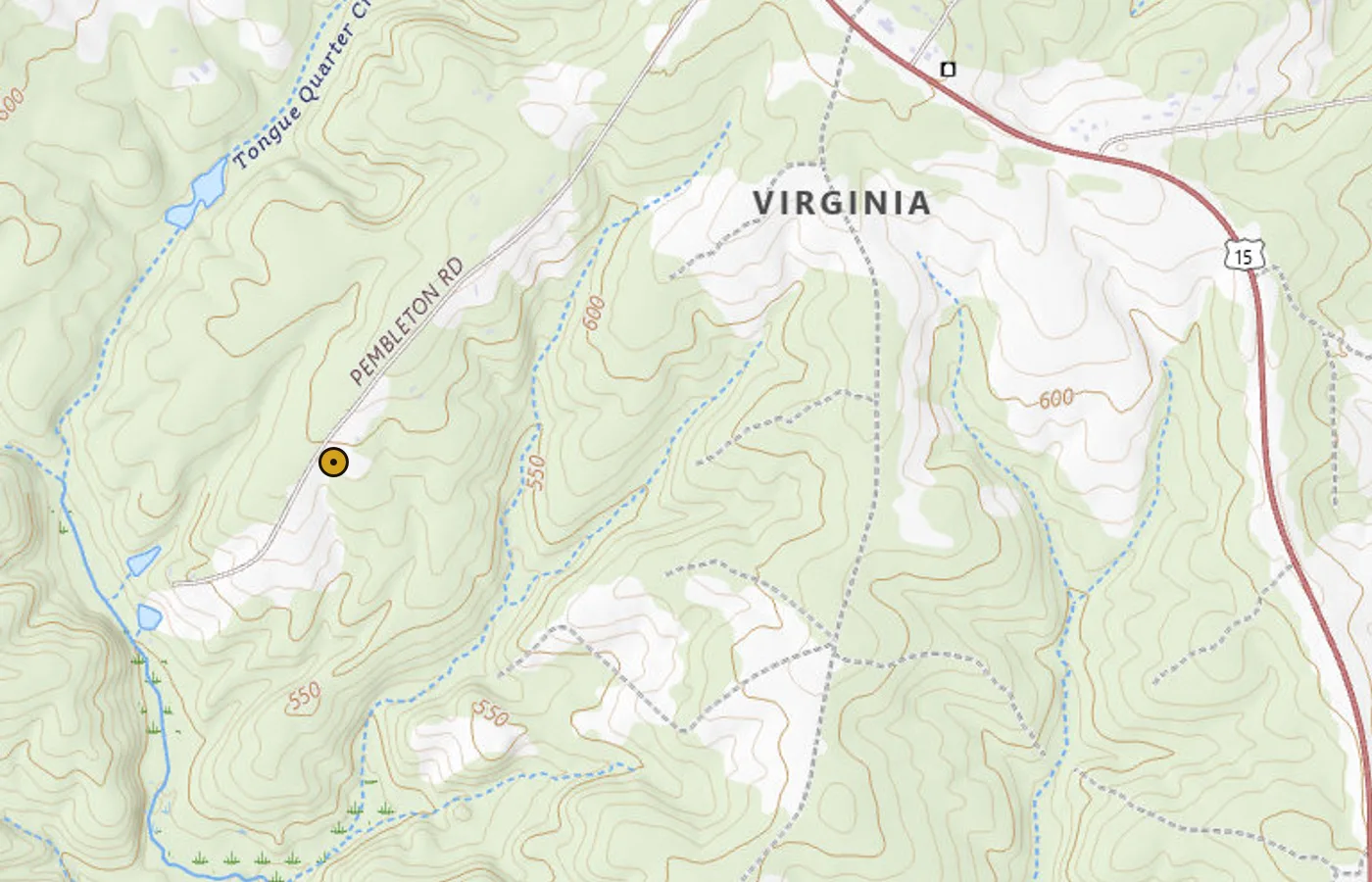
- Known for
- Early commercial Buckingham gold mine; long alias chain (Booker / Garnett / Moseley / Morrow)
- Also called
- Garnett, Moseley, and later Morrow Mine on the same property
- County / quad
- Buckingham County · Willis Mountain
- First worked (approx.)
- Named by Rogers (1836 print of 1835 recon); local commercial start often cited ~1832
- Site type
- Open cut + multi-shaft underground; placers nearby
- Inventory
- Sweet Pub. 19: MORROW (Booker, Garnett, Moseley); map layer may list unlabeled shafts nearby
- Field remains (Sweet)
- 3 caved shafts; ~35 caved pits; open cut, trench, dumps
- Note
- Not a pure name match on current map JSON; center on published Sweet coordinates
Booker is one of the names Virginia gold history keeps pointing to when the conversation moves into Buckingham County.
On maps and in technical reports you will also meet the same ground as Garnett, Moseley, and later Morrow. The paper trail is unusually long for a Piedmont mine: early plantation-scale work, mid-century English capital and a large stamp mill, then intermittent reopenings into the twentieth century.
For research, treat all four labels as one district camp on the Willis Mountain country, not four unrelated pins.
Where it sits
Palmer Sweet's inventory lists the site as MORROW (Booker, Garnett, Moseley) on the Willis Mountain 7.5′ quadrangle in Buckingham County. His published location is about 2.2 miles northwest of Willis Mountain, west of State Road 774 south of its junction with U.S. Highway 15 (UTM Zone 17N N 4,152,590 / E 721,570).
Stephen Taber (1913) places the same property about 3.5 miles southwest of Dillwyn and two miles east of Enonville. That is the dense historic-mine neighborhood south of Dillwyn, in the same Gold-Pyrite Belt story as the rest of central Virginia.
When Sweet visited, field notes were blunt: three caved shafts, about thirty-five caved pits, an open cut and trench, and dumps. On VaGoldMaps the nearest inventory markers are often unlabeled shafts and pits on that ridge, with Seay Mine adjoining on the west. Booker or Morrow may not appear as a pure name string on the layer. Use the coordinates on this page as the research center, then compare neighboring gold pins.
First commercial gold camp in Buckingham
Local history puts the first commercial gold mine in Buckingham on Bernard Gaines Booker's plantation about three miles from Sprouse's Corner, often dated to around 1832. Stock in Booker's mine was already on the market by 1835. Before California, central Virginia (including Buckingham near Willis Mountain) was among the better-known gold regions in the country.
An 1838 letter from Buckingham described company work after 1836: large steam machinery plans, a poorly placed shaft, then a cheaper layout with stamps and washers on a productive vein opened about fifty feet deep. Family lore remembers Capt. Booker sporting carriage-driver jacket buttons of Buckingham gold. Treat that as color. The rock record and the early survey reports are the cleaner research base.
What Rogers wrote in 1835-1836
William B. Rogers directed Virginia's first geological survey after the General Assembly authorized a reconnaissance in March 1835. His work that season became the 1836 Report of the Geological Reconnoissance of the State of Virginia for the Board of Public Works. In the section Of the Auriferous Rocks, he treats the gold belt from Spotsylvania through Orange, Louisa, Fluvanna, and Buckingham, and he names Booker's as a working example, not a rumor.
On wall-rock hardness he pairs Buckingham mines:
At Morton's mine, the rock is removed with difficulty even by the blasting process, while at Booker's and some other mines its texture is so rotten that it rather presents the appearance of earth than rock.
Rogers goes straight to the research point that still matters on a stream map. Soft rotten walls of that kind, under favorable conditions, could feed what he calls deposite mines: clay, sand, and gravel with gold moved by streams into adjoining ravines and hollows. In other words, as early as the recon he links Booker-style ground to both lode work and nearby placer washings.
On vein shape, still in the same section:
In Morton's mines, the width varies from seven feet to five or six inches. In Booker's the vein forks, thins, and as frequently widens. At the Union mines on the Rappahannock, the breadth varies in some cases from six inches to nearly three feet.
From any one spot on an auriferous vein, he warns, you cannot read the rest of the strike or the depth with certainty. Pinch and reappear is the pattern. That is the first formal geologic description of Booker by name, decades before Taber's Morrow chapter and still useful when you zoom LiDAR on the Willis Mountain ridge.
Rogers also notes that wall rock next to the quartz can itself be auriferous, with several striking instances in the mines of Buckingham, and that Spotsylvania, Orange, Louisa, Fluvanna, and Buckingham already had numerous veins wrought with rich returns. He argues the gold quartz as veins of injection rather than beds laid down with the slates. That theoretical dispute shows up again in Silliman a year later.
What Rogers does not give you: company names, stamp-mill counts, production tables, or a claim that Booker was the "first" Buckingham mine. Use him as the 1830s survey pin. Soft walls, forking vein, Buckingham district already live.
Silliman's 1836 field tour (and what it does not say)
Benjamin Silliman Sr. published Remarks on some of the Gold Mines, and on parts of the Gold Region of Virginia in the American Journal of Science and Arts (volume 32, 1837), from visits in August and September 1836. He is careful that the article is not a general inventory. For the big picture of the belt he points readers to Rogers:
…reference for more general views may be had to the Report of the Geological Reconnaissance of the State of Virginia, by Prof. William B. Rogers…
Silliman rode roughly eighty miles of gold country "from the Union mine, in Fauquier County, to the mines of Buckingham." Buckingham is on the SW end of that line of march. What he does not do is name Booker, Garnett, or Moseley in the published AJS paper. His detailed plant-and-assay write-ups go to Moss and Busby's (Goochland), Walton and Tinder's (Louisa), Culpeper on the Rapidan, Fisher/Hughes, Whitehall as a deposit-mine anecdote, and opened or unopened tracts in Fauquier and Culpeper.
Still, the 1836 note is useful Booker-belt context. He separates vein mines from deposit (alluvial) mines, describes free gold in quartz and in rotten slate, stresses that washings lose fine gold if you are careless, and reports industry talk that working costs often sat near thirty to thirty-five cents per hundred pounds of ore when a dollar of gold on that tonnage was already "profitable" ground in contemporary language. His caution about gold fever is still a good research motto:
Virginia has, in her territories, great mineral treasures; but they are to be obtained only by sober industry and skillful application of knowledge and capital…
For Booker research: use Rogers for the named 1830s geology and Silliman for how the wider belt looked when capital was flooding in, not as a stand-in site report for this pin.
Garnett, Moseley, consolidation, and English capital
In its mid-century prime the property ran as two mines on the same vein within about 100 yards: the Garnett Mining Co. and W. M. Moseley and Co. In 1852 they were consolidated and incorporated under Virginia law. For several years after, an English company controlled the works. Period literature and stock paper therefore say Garnett and Moseley, Booker, or both.
Development was serious by Piedmont standards. Before deep work, most of the upper Booker vein was taken by open cut to about 30 feet for more than 400 yards along the outcrop. By about 1853, reports describe several shafts (hoisting, ventilation, pumping) averaging roughly 100 feet, connected by drives on the order of 350 feet, with the vein tested for over half a mile by shallow shafts and dozens of surface cuts. Later stoping extended underground work, but shafts do not appear to have gone much below about 115 feet.
Plant capital kept climbing and often outrunning sense. Two small mills while Garnett and Moseley ran separately. In 1854, after English purchase, Partz reports a new mill with 72 stamps (up from 24) and amalgamation on shaking tables. Taber notes the familiar Piedmont problem: expensive machinery swapped out after little use. Credner (1865) found the mines shut after the Civil War still littered with stamps, tables, and unused crushers. Around 1880 the Morrow Mining Co. worked the ground, and the Morrow name stuck. A 1893-94 attempt to treat sulphides by the Mears chlorination process recovered gold but failed on mechanical defects. When Taber visited in 1911, openings were partly caved and no mill remained. USGS-style summaries also note work in 1938, with bullion shipped to the Philadelphia Mint and concentrates to Carteret, New Jersey.
What the production record actually says
There is no solid total production figure for the life of the property. Taber says so plainly. Partial windows are still useful for map research:
- A 1852 Garnett company prospectus claimed about $26,500 for the previous year across both mines (Mint receipts plus gold on hand / specimens).
- Henwood tabulated Troy pounds of gold for 1850-1852 separately for Garnett and Moseley (mid-century run rates, not a life total).
- Placer washings near the veins were said to have returned more than $60,000. Henwood quotes a near 9-pound nugget (plus many ounce-scale pieces) in a rivulet immediately south of the Garnett and Moseley works.
- Period assays: selected samples up toward a few ounces; averages near 8-10 dwt from about 90 feet reported for the two shafts.
Henwood believed values declined with depth in the principal bed (shallower, narrower ground richer than deeper, wider, flatter ground). That is period observation, not a guarantee of modern residual grade. For the map it is enough to know Booker / Morrow was a real camp with free-milling surface ore, documented mill capacity, and enough longevity to reappear under new money into the 1930s.
Vein geology in plain language
Rogers already saw the forking, soft-walled vein in the 1830s recon. Taber places the same ground in intensely metamorphosed schists and gneisses (often read as metamorphosed sediments). Nearby ground includes hornblende schists toward Tongue Quarter Creek and the bold kyanite / quartzite of Willis Mountain a couple of miles southwest. Dump material is schistose, often garnetiferous, with biotite, sericite, magnetite, and iron-calcium carbonate noted in thin section.
The ore style is a principal auriferous bed plus several parallel gold-bearing beds that follow schistosity, widen, split, pinch, and reappear. Widths of a few feet to more than ten feet appear in the literature. Near surface, gold can be disseminated through quartz, rotten schist, and walls; deeper, observers describe gold gathering into quartz bands and threads, with quartz growing to roughly 10 feet thick near 100 feet depth in Ansted's account. Quartz veinlets also reticulate through schist with wallrock inclusions: a fracture-zone picture Taber uses as a textbook example for the James River gold belt.
Free gold near the surface, more sulphide- and pyrite-tied material at depth, occasional tellurium with gold (not abundant), and silver reported with the gold. That is the same broad Piedmont pattern described in how Virginia gold sits in the rock: oxidized easy ore first, harder sulphide ore and deeper ground later.
The adjoining Seay property to the west was held by the same company in Taber's day: placers, small quartz veins with pyrite and gold, a prewar mill, and a reported post-war shaft to about 150 feet with little further result. On the map, Seay is one of the few nearby pins that still carries a name.
What LiDAR shows near the pin
Topo tells you US 15, SR 774, and how the ground sits relative to Willis Mountain. LiDAR strips the canopy and shows bare-earth texture: pits, cuts, benches, and dump-like irregular ground that maps as a quiet timber ridge until you zoom in.
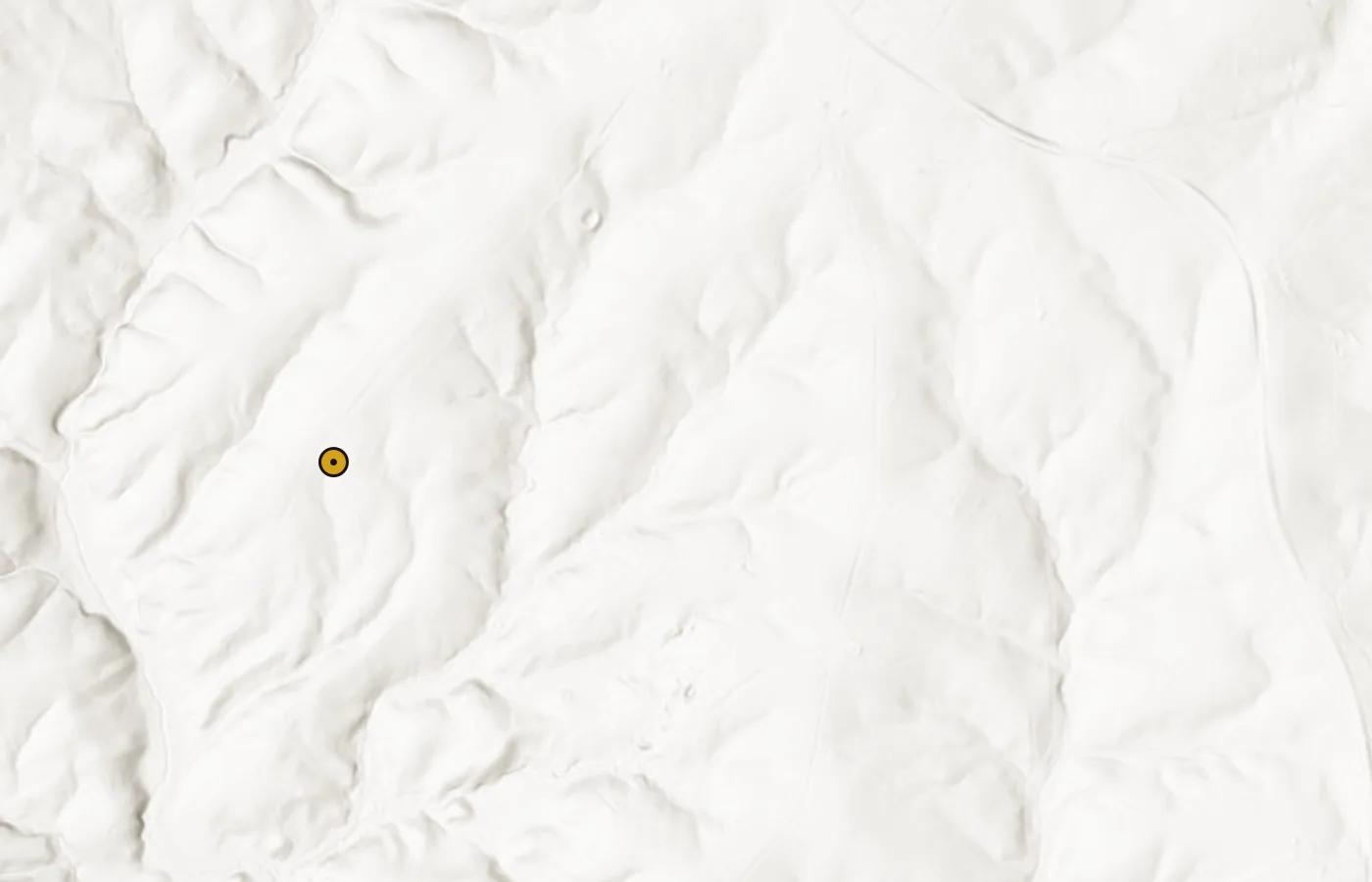
Zoom on the Booker coordinates with LiDAR and streams on. Trace how drainages leave the mineralized ridge. Historic open cuts and placer washings would have followed water away from this same system. For a fuller walkthrough of the layer, see What LiDAR can show you before you ever hit the creek.
How to study Booker on VaGoldMaps
Open the map pin for this page. You are centering Sweet's published Morrow / Booker / Garnett / Moseley location on the Willis Mountain quad.
- Historic mines: Compare the unnamed shaft and pit cluster on this ridge with named neighbors such as Seay, then pan the broader Dillwyn and Willis Mountain district. Central-belt peers on this site include Tellurium on the Fluvanna / Goochland line.
- Streams: Follow modern creeks leaving the ridge. Taber's placer notes and the old 9-pound-nugget rivulet story are drainage research questions, not dig instructions.
- LiDAR: Look for disturbed ground, old cuts, and benches under tree cover.
- Structure: Turn on faults and preferred intersections when you want a "why here" layer beside the company-name story.
For inventory fields on any marker (names, MRDS, references, reclamation rank), see the Field Note on historic mine details.
Access and honesty
Booker's coordinates are for study. The site and surrounding parcels are not a free-entry prospecting invitation. Confirm ownership and permission before any visit. Historic mill and dump ground can also carry legacy hazards from nineteenth-century processing (including mercury amalgamation).
A roadside historical marker in Dillwyn (F-55) remembers this as one of the country's notable early gold regions and notes Morrow as an early underground operation opened before 1835. The marker is a town pin, not the mine portal.
If you only remember one Booker fact, remember this: Rogers already named Booker's forking, soft-walled vein in the 1836 recon, and the same ground later runs as Garnett & Moseley, then Morrow, with Taber, Henwood, and Sweet filling the plant and inventory story. Everything else here is how to put that pin to work on the map.
Related research
Sources
- Rogers, W. B. (1836), Report of the Geological Reconnoissance of the State of Virginia, Board of Public Works (field recon authorized 1835; "Of the Auriferous Rocks": Booker's soft walls vs Morton's; "In Booker's the vein forks, thins, and as frequently widens"; Buckingham wall rock also auriferous). Digitized: Internet Archive reportgeologica00workgoog
- Silliman, B. (1837), Remarks on some of the Gold Mines, and on parts of the Gold Region of Virginia… (observations Aug-Sept 1836), American Journal of Science and Arts, vol. 32, pp. 98-130 (defers general belt treatment to Rogers; itinerary Union mine in Fauquier to the mines of Buckingham; detailed write-ups of Moss/Busby, Walton, Culpeper, Whitehall deposit notes, etc.; does not name Booker)
- Sweet, P.C. (1980), Gold in Virginia, Virginia Division of Mineral Resources Publication 19 (MORROW / Booker, Garnett, Moseley inventory: Willis Mountain quad; UTM; field observations; references)
- Taber, Stephen (1913), Geology of the gold belt in the James River basin, Virginia, Virginia Geological Survey Bulletin 7, pp. 198-205 (history, plant, partial production, descriptive geology, placers; paraphrases Rogers-era activity at Booker's)
- Henwood, W. J. (1871), Observations on Metalliferous Deposits: Notices of Gold Mines in Virginia, Transactions of the Royal Geological Society of Cornwall, 8 (1), 371-384 (beds, 1850-1852 production table, placers)
- Partz, A. (1854), Examinations and Explorations on the Gold-Bearing Belts of the Atlantic States, Mining Magazine vol. ii (72-stamp mill; amalgamation)
- Mining Magazine (1853), The Garnet and Moseley Mines, Virginia (reprint from the Richmond Enquirer), vol. i, pp. 164-167
- USGS / Diggings-style mineral record summaries for Morrow Mine near Dillwyn (alias chain; 1938 Mint / concentrates shipments)
- Yeck, Joanne L., Slate River Ramblings posts on Buckingham Gold and Booker Mine (local commercial-start context; 1835 stock sale; 1838 Madisonian letter)
- Virginia Energy Geology and Mineral Resources, Buckingham County overview (district mining history; nearby reclamation notes for other mines)
- Historical Marker F-55, Gold Mines, Dillwyn (Morrow Mine opened before 1835; early underground mining)
VaGoldMaps is for research and education. Historic mine coordinates are not a claim to ownership or access. Confirm land status and get permission before any field visit.